Login Instructions for Trent University's ArcGIS Online Portal
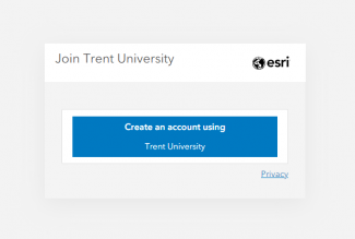
As of September 1st, 2024, MaDGIC has implemented a new login option for Trent University's ArcGIS Online Portal. Use the steps below to log in to www.trentuniversity.maps.arcgis.com using the appropriate account type.
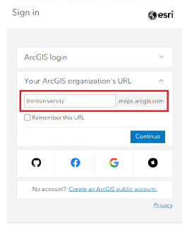
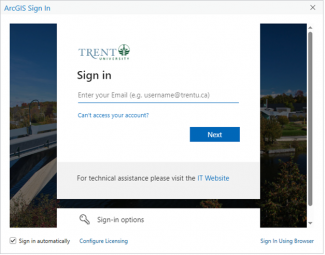
Note- If you are presented with the screen below, enter ‘trentuniversity’ into the text box (as shown) and select "Continue" to proceed to Trent University's login page.
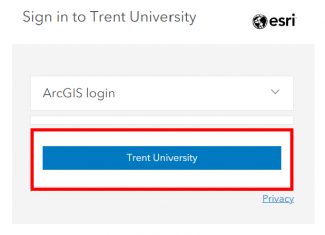
If you are a new user (you joined the organization in September 2024 or after):
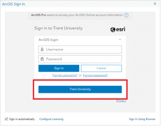
- Use the blue "Trent University" button to log in to ArcGIS Online.
- Your username and password are the same as your myTrent credentials.
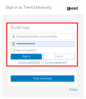
If you are an existing user (you joined the organization before September 2024):
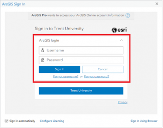
- Expand the ‘ArcGIS login’ option to sign in.
- Your username is formatted as firstnamelastname_trentuniversity (the first part of the username should be the same as your Trent email address with the @trentu.ca removed; for example, if your Trent email only uses your first initial such as jsmith@trentu.ca, then your username will be jsmith_trentuniversity).
- Your password is the one you set when you registered your account. If you have forgotten your password or have any issues with your account, contact madgichelp@trentu.ca for assistance.
About ArcGIS Online
ArcGIS Online is Esri's cloud-based platform used to analyze and explore geospatial data, and create interactive web maps and 3D web scenes to easily share and collaborate with people in the organization or the public. Web maps can integrate with many of Esri's applications like StoryMaps, Dashboards, or Field Maps. You manage access to your content stored within Trent University’s Online Portal by setting the sharing level.
In ArcGIS Online you can
- explore base maps and online data sources from Esri and other providers
- add your data to the map and change the symbology
- perform basic geoprocessing and data analysis
- explore Trent's gallery of content created and shared by other users.
About ArcGIS Online Credits
Your account uses a credit-based system, which means that cloud-based services used in ArcGIS Online (for example, analyzing data or storing content) will consume credits. The university receives a fixed number of credits and assigns 100 credits to each account. This is usually more than enough to cover typical use cases however processes like large-scale geocoding may require more credits than you have available. Visit Esri's help documentation for more information on credit consumption in ArcGIS Online.
We recommend using ArcGIS Pro desktop software for intensive data processing and analysis tasks to avoid maxing out your ArcGIS Online credits. If you would like to request an exception to the default credit limit or explore options for designing GIS workflows, please email us at madgichelp@trentu.ca to discuss options.
Recommended Resources for Getting Started with ArcGIS Online
